Neom
Government Sector
GIS, Photogrammetry & Geoportal Services
This project, spanning 60,000 km² in Saudi Arabia, aimed to establish advanced geospatial infrastructure for NEOM. Key deliverables included system design, the establishment of CORS networks, and multi-scale mapping (1:20,000, 1:25,000, and 1:100,000) covering orthophotos, land use/land cover, wadi mapping, and cadastral surveys. Additionally, the project incorporated geodatabase creation, GIS/LIS, and Geoportal development to support smart geospatial data integration and decision-making.
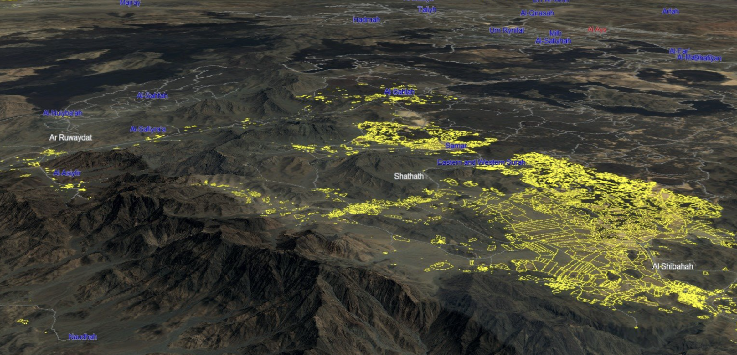
Royal Commission of AlUla (RCU)
Government Sector
GIS, Photogrammetry & Geoportal Services
This project covered 23,000 km² to develop a 3D GIS framework for AlUla's historical and archaeological sites. Key activities included system design, collection of existing data, and multi-scale mapping (1:20,000 and 1:1,000) using orthophotos, LIDAR imagery, and high-resolution drone and aerial imagery. Outputs included DEM/DSM contouring, cadastral surveys, and 3D geospatial data modeling for advanced analysis. Additionally, a geodatabase, GIS/LIS, and Geoportal were developed to support smart geospatial infrastructure.

Jeddah Amanah
Government Sector
Geospatial Data & GIS Project
Spanning 2,400 km², this project aimed to create a comprehensive Digital Twin for Jeddah. Key activities included establishing ground control points, acquiring 7.5cm GSD aerial imagery, and producing DSM, DTM, DEM, and true orthophotos for digital mapping. The project delivered a 3D Digital Twin, 3D terrain models, and integrated geospatial data through advanced conversion techniques. A geodatabase and Geoportal were also designed and implemented to enable seamless data access and management.
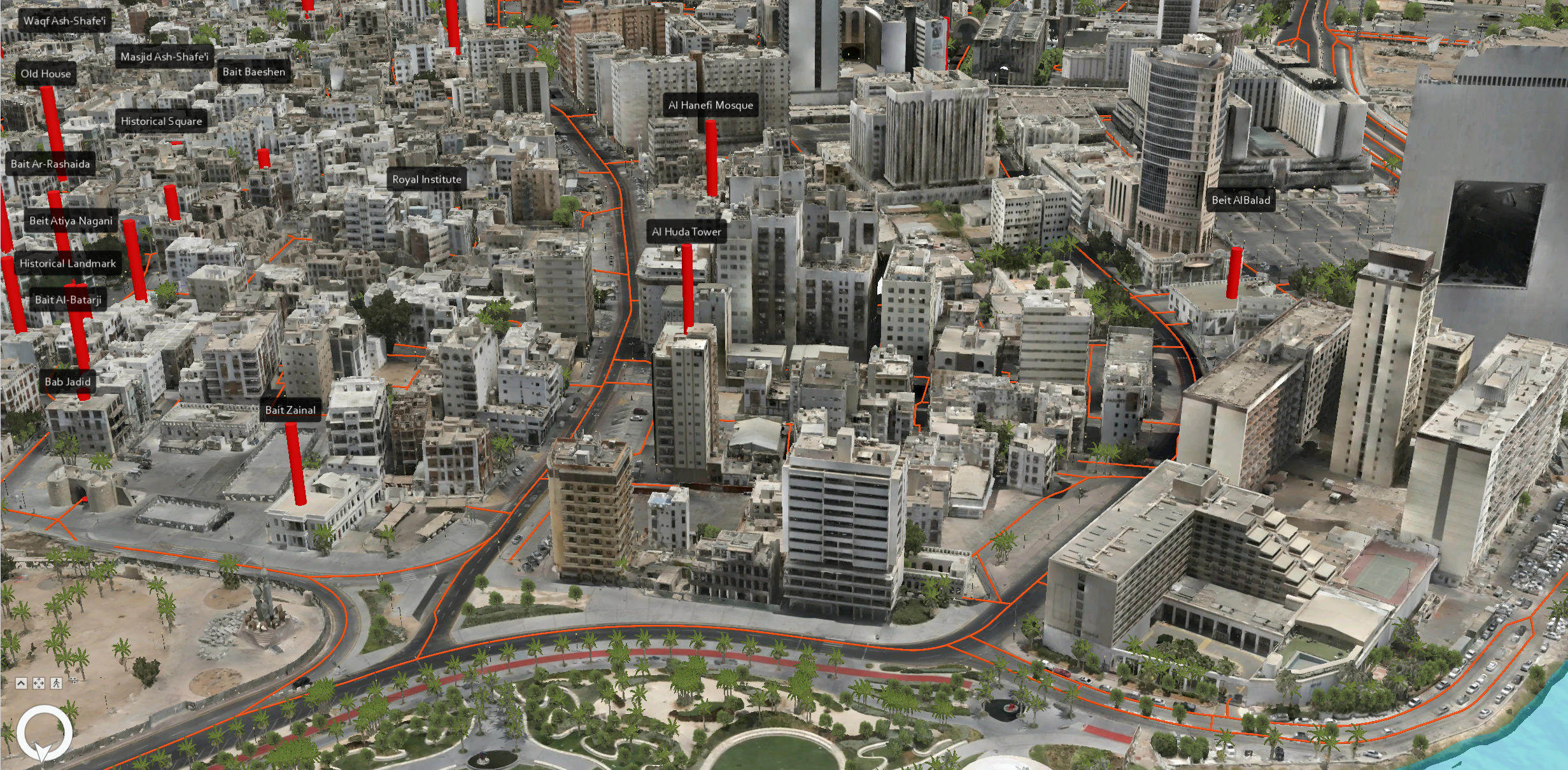
Holy Makkah
Municipality
Government Sector
GIS, Photogrammetry & Geoportal Services
Covering 2,600 km², this project developed a 3D Digital Twin for Makkah, integrating advanced geospatial data. Activities included establishing ground control points, acquiring high-resolution aerial imagery (7.5cm/5cm GSD nadir and oblique), and producing DSM, DTM, DEM, and true orthophotos for accurate digital mapping. The project delivered 3D terrain models, seamless data conversion and integration, and the design of a geodatabase and Geoportal to enhance geospatial data management and analysis.

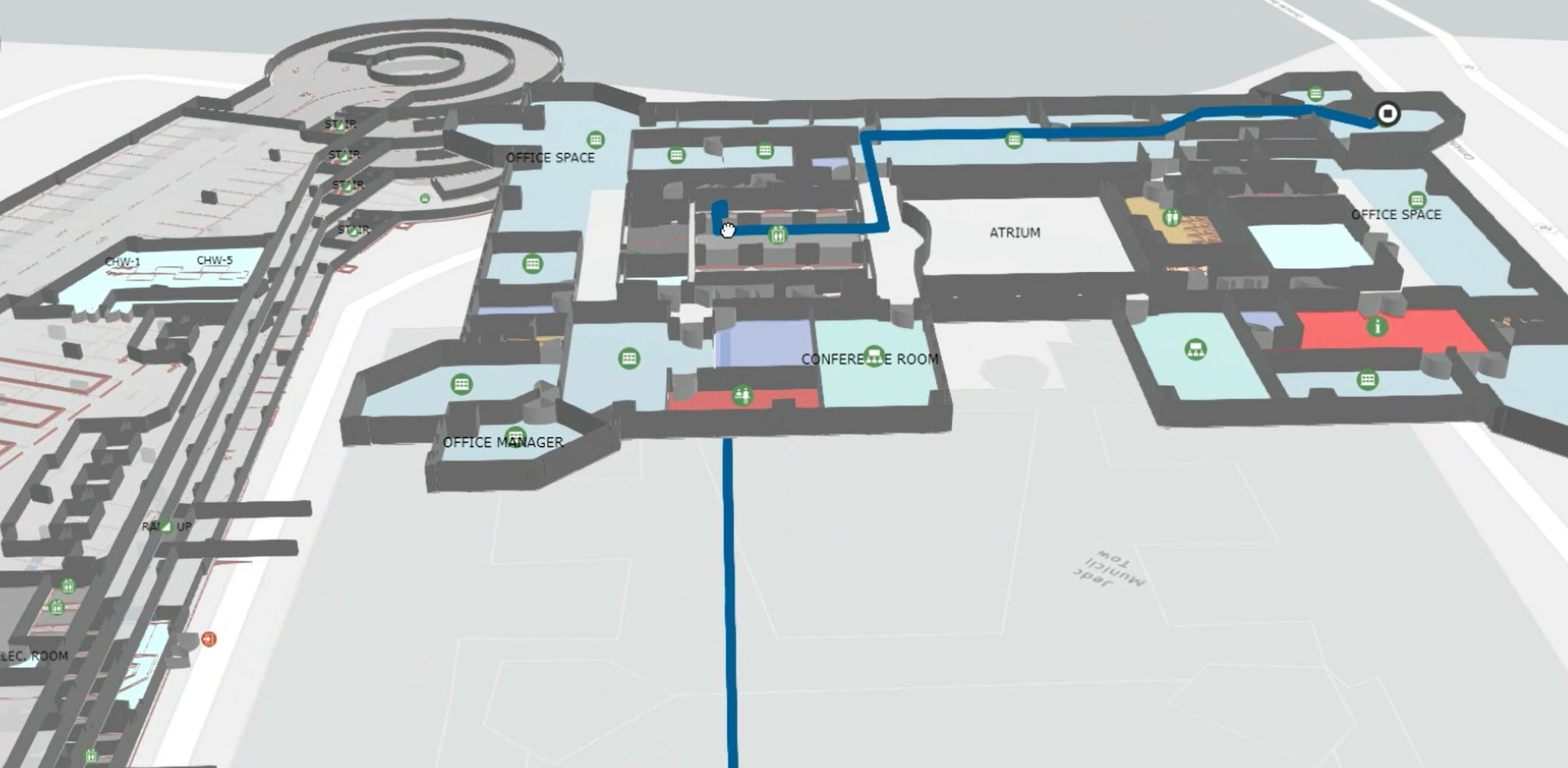
ETH Zurich
Government Sector
Geospatial Data & GIS Project
This project involved curating detailed indoor geospatial data for 58 buildings, encompassing 413 floors, 33,699 rooms, and a total building area of 443,343 m². The curated data included 1,763,897 m² of room areas, 2,059,050 m² of floor areas, and 3,575,833 detailed line features. An indoor network was established with 36,399 pathway features spanning 304,841 meters in length and 2,548 transition features, enabling efficient navigation and spatial analysis within ArcGIS Indoors.